DEVELOPMENT NOTES · 3D GIS
Unreal Engine GIS Viewer
In development · Desktop application · Developed with AI assistance
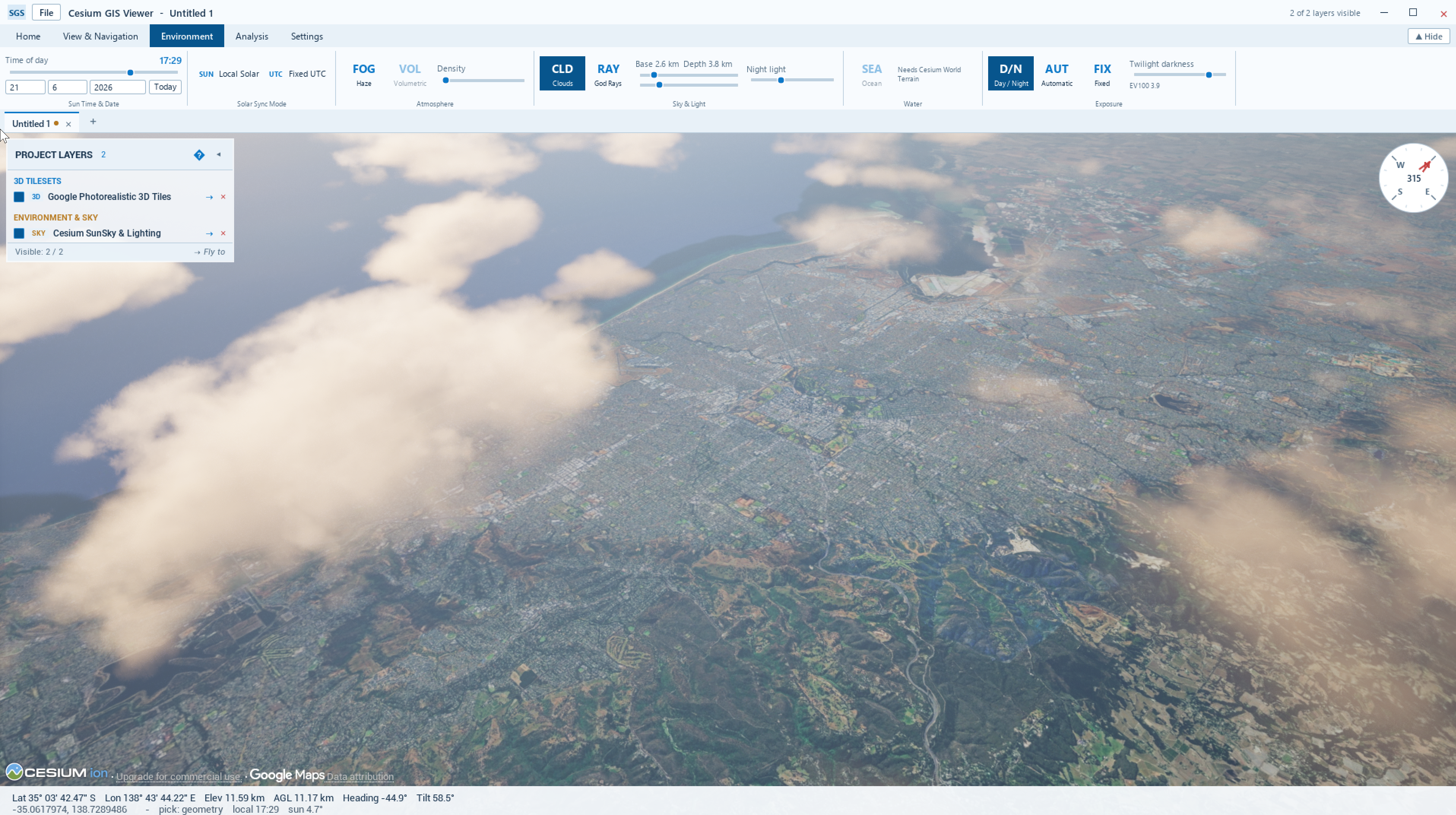
I’m developing a desktop GIS viewer that combines Cesium’s geospatial streaming and globe positioning with Unreal Engine’s rendering and environment systems. The interface provides a ribbon, project layers panel and navigation controls for working with 3D geographic data.
Architecture and georeferencing
The application is written in C++ and uses Cesium for Unreal for georeferenced 3D Tiles and imagery. The desktop interface is built with Unreal’s native Slate UI framework. Navigation keeps orbit pivots and flight targets in Earth-centred, Earth-fixed (ECEF) coordinates, so they remain geographically anchored when Cesium shifts the local Unreal origin.
Data and layer management
The layer manager includes loading paths for local and remote 3D Tiles, plus WMS, WMTS and XYZ imagery overlays. The project layers panel provides visibility and fly-to controls. The screenshot shows Google Photorealistic 3D Tiles together with a Cesium SunSky environment layer; data access depends on the relevant service credentials and licensing.
Environment controls
The environment tools combine Cesium SunSky with Unreal atmosphere, fog, cloud and exposure controls. The ribbon exposes date and time settings, local solar and fixed UTC modes, cloud base and depth, fog density, day/night lighting and automatic or fixed exposure. These are visual rendering controls rather than a weather simulation.
Development status
The viewer is still in development. Current work focuses on integrating data sources, navigation and environment controls into a consistent desktop workflow. A downloadable release is not available here yet.
← Back to applications